Towards more accurate simulation of Copernicus Sentinel optical data
This is an extended version of a story published on the Copernicus Sentinel portal.
The Copernicus programme is more than ever a cornerstone of many scientific research and engineering activities and is an important part in the development of public policies. It is therefore of prime importance to ensure that this data is accurate and reliable: How certain can we be that the values we are looking at are what they seem to be?
Satellites record light #
Before diving into the details of accuracy and reliability, let’s take a step back and start from what Copernicus satellite data is about. To say it quickly, satellite imagers are sophisticated spaceborne cameras, which we call radiometers. Common improvements over regular cameras are a higher resolution and more “colours” (a.k.a. spectral bands), including some outside the visible spectral range.
Just like any camera, radiometers record light originating from two sources: Sun light scattered by the Earth, and light emitted by objects located on the Earth. Every object in the Earth system, e.g. land and water surfaces, atmospheric gases and clouds, emits and scatters light in a unique way. This is what makes remote sensing possible.
Remote sensing meets metrology #
Remote sensing is the art of interpreting the images captured by airborne and spaceborne radiometers. Out of a collection of pixel values, a date and location, we try to infer facts about the objects which scattered and emitted the light recorded by the radiometer. Remote sensing starts with a measurement, i.e. the interpretation of the raw signal sent by the radiometer to get an image as close as possible to the sensible reality. The raw image is then processed for many purposes: images can be assembled to cover larger areas, processed to remove the effect of atmospheric scattering and visualise ground-level features, processed again using image processing techniques to detect objects like fields or buildings, etc.
Every step in this measurement and processing chain uses models which are potential sources of uncertainty and error. Quantifying and keeping track of them is essential when it comes to assessing how accurate and reliable remote sensing data is. The a part of the scientific field of metrology is dedicated to that. Metrological principles are in the process of being implemented to remote sensing as successfully demonstrated by the FIDUCEO H2020 project. Ensuring data traceability is however not enough to guarantee that measurements are accurate. To that end, a measurement chain must be calibrated, i.e. compared to a trusted reference.
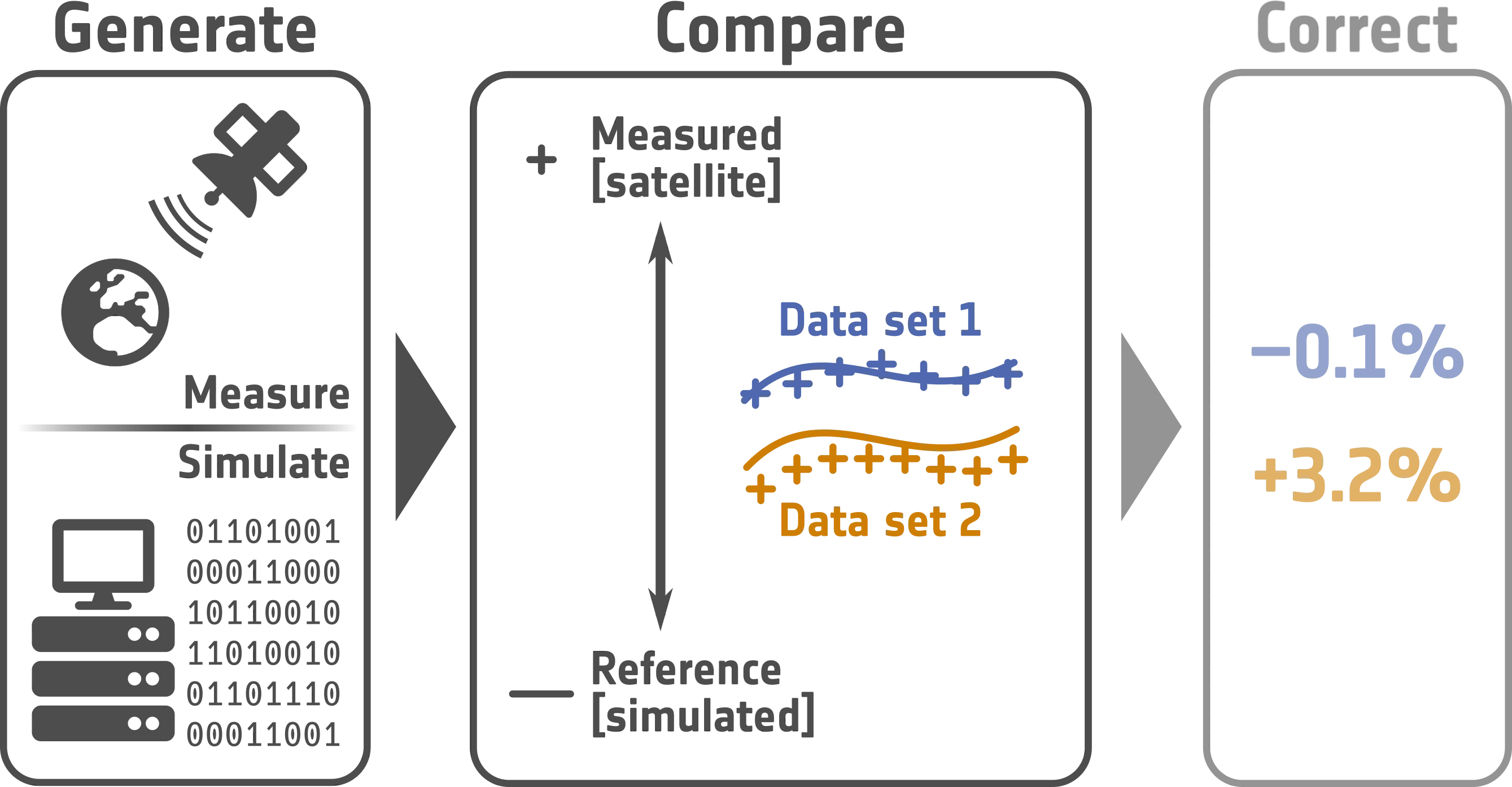
The calibration process for radiometric instruments onboard satellites is a complex one because we cannot take the instruments down to the lab. Dedicated missions, such as TRUTHS, are in preparation to provide reference radiometric data, and their output will be compared to other satellite observations and numerical models. These future missions, as well as current radiometers on-board the Sentinels, have reached unprecedented accuracy, challenging the scientific community on their capacity to make best use of this accuracy.
Eradiate, a new simulation tool to help with instrument calibration #
Numerical simulation of radiative transfer applied to Earth observation is an active field of research. The complexity of the Earth system requires clever modelling strategies to reduce the computational cost of simulations, usually at the cost of accuracy. Software technology needed to easily build scenes suitable for highly coupled systems with vegetation, realistic atmosphere, water bodies and many other features was, until not so long ago, out of the reach of many EO scientists. However, recent advances in apparently unrelated fields, such as computer graphics, opened new perspectives for radiative transfer.
The Eradiate radiative transfer model is a new attempt at making a technological quantum leap in the field of radiative transfer for EO. It leverages technology originally applied to computer graphics to easily build scenes of arbitrary complexity, mixing all kinds of geometry and objects, and perform accurate radiative transfer simulations on them. Eradiate will be released under the GNU Public License and is designed as a modular and evolutive radiative transfer simulation tool suite. Eradiate should allow to reach the numerical accuracy required to calibrate modern radiometric instruments, enabling remote sensing data providers to guarantee the accuracy and reliability of their data to users and decision-makers.
Eradiate is developed by Brussels-based company Rayference in the framework of a Copernicus-funded ESA project. This model is designed to support the work of the multiple scientific communities dealing with Earth Observation data. The first beta release is scheduled for early 2021. This first public release of Eradiate will be associated to a user workshop organised at ESRIN in January 2021. For more information, do not hesitate to subscribe to our newsletter.
About the Copernicus Sentinels #
The Copernicus Sentinels are a fleet of dedicated EU-owned satellites, designed to deliver the wealth of data and imagery that are central to the European Union’s Copernicus environmental programme.
The European Commission leads and coordinates this programme, to improve the management of the environment, safeguarding lives every day. ESA is in charge of the space component, responsible for developing the family of Copernicus Sentinel satellites on behalf of the European Union and ensuring the flow of data for the Copernicus services, while the operations of the Copernicus Sentinels have been entrusted to ESA and EUMETSAT.